 |
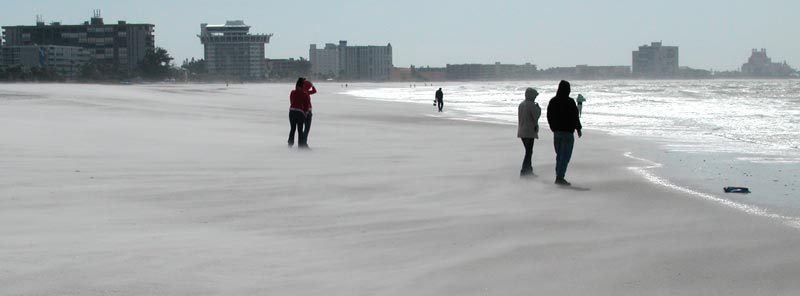
| Above: Monday, Oct 24, 2005.
Sightseers on Upham Beach covering their eyes from the blowing sand
after the passage of Hurricane Wilma. |
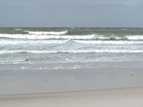 Upham
beach surf from Wilma plus cold front. Upham
beach surf from Wilma plus cold front. |
 |
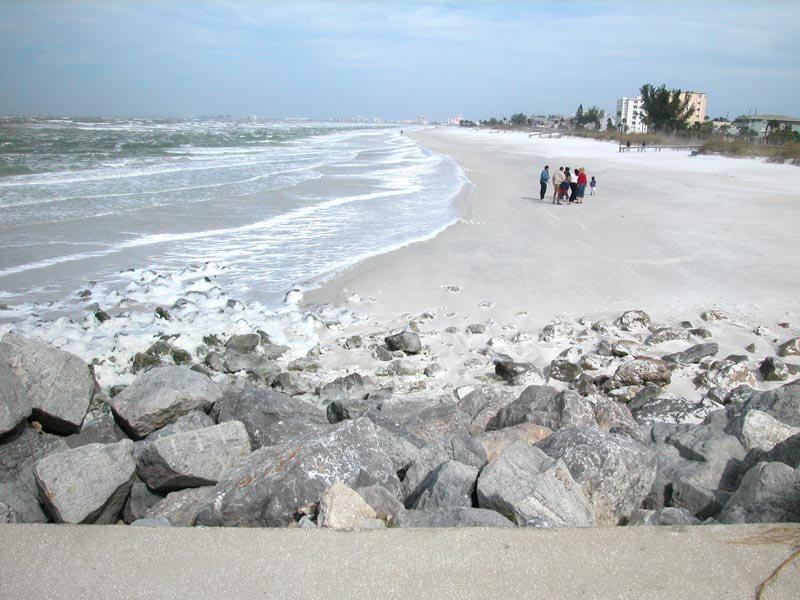
| Above: St. Pete Beach,
Pass-A-Grille. Winds 50+ mph. Blinding sand. You can see the blowing
sand over the dunes. |
 |
| Above: I'm standing on the jetty at Pass-A-Grille
channel. The wind is so strong I can barely stand. The foam you see
piled up on the rocks below is flying at me in chunks and hitting me in
the face. This is the strongest wind I've ever been out in. I could
actually lean into the wind at a 45 degree angle and stretch out my arms
like wings and the wind would hold me up like I was flying. The wind is
straight out of the north and is in the upper 60's. Quite a change from
the hot, muggy, tropical weather we've had for the last 7 months. |
 |
| Above: This young couple decided to stroll out onto the
jetty and has just walked through a tremendous blast of blowing sand.
The wind is funneling up from the beach, through the break in the sea
oats to the right and is carrying a lot of sand that really stings. You
had to cover your face. I now have sand in my ears, my hair, my
eyebrows, my mouth, down my neck... |
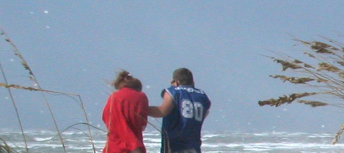 |
| Here is a cropped portion of the same couple. See the
white specks all over the photo? Those are flying chunks of sea foam
filling the air. The wind is MUCH stronger at Pass-A-Grille than at
Upham beach, just a few miles to the north. This is because of the curve
in the island. Upham faces more southerly and is slightly sheltered,
while Pass-a-grille is more exposed to the north wind. Not a good day
for boating I would say. |
|
